


- Location
- TRURO CORNWALL
With the Bank Holiday weekend here I’m pleased to say the weather will be good mostly dry, sunny and increasingly warm across England and Wales.
As I pointed out in my last update this current taste of summer would be a north south spilt with the driest and warmest temperatures in the south and coolest and wettest in the north, and that was the case, but over the next week and in to the start of September it’s looking like the whole of the UK and Ireland will see warm or very warm temps as high pressure sites over the British Isles.
Monday temps are likely to climb above 26C/79F in central and south-east England. The NW will be hanging on to rain with fresher and showery weather following into midweek here. While rest of the UK will be dry and warm this spreading to all the UK by the end of the week.
Saturday26th -8
Dry and bright day across central & southern Britain. With sunny spells. By afternoon, sunshine best around coasts in the west & south. In Scotland & northern England, turning showery with rain following overnight some areas. Showers pushing slowly into north-eastern counties and fading, although local bursts may continue in the east Winds light. Highs of 24C-75F.
Sunday27th -8
With High pressure across southern Britain a dry day with sunshine, best around coasts in the afternoon. Light and variable winds and sea breezes. Again wetter in the NW with freshening south-westerly a risk of a few drizzly showers, but amounts small, and areas east of high ground should stay dry. Highs range from 16C-61F to a very warm 27C- 80F in the south-east.
Monday28th-8
Dry, sunny and very warm Bank Holiday Monday for most of England & Wales. Sunshine may turn hazy as cloud builds from the west. weather Fronts moving in from the Atlantic bringing persistent rain to Ireland & Scotland, heaviest over western hills, slowly moving south through the day, Highest temps in the SE England with 28C -82F possible.
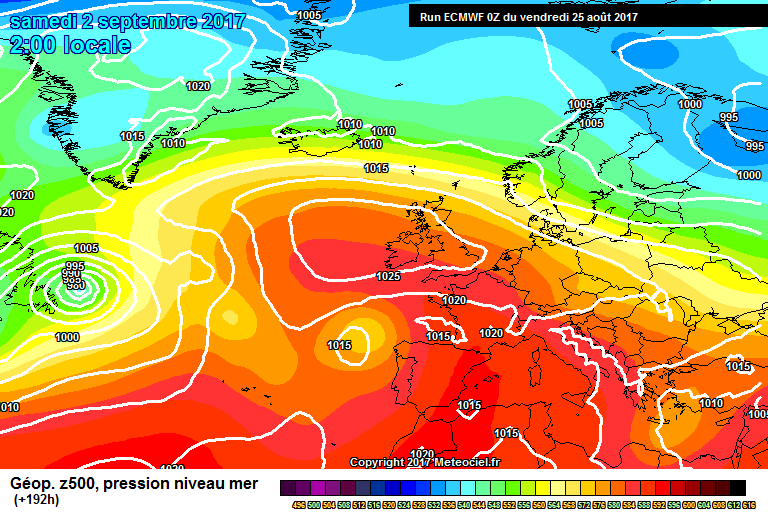
This is the chart for SAT 2nd September. warm dry and sunny.
Whatever your weather enjoy it!
As I pointed out in my last update this current taste of summer would be a north south spilt with the driest and warmest temperatures in the south and coolest and wettest in the north, and that was the case, but over the next week and in to the start of September it’s looking like the whole of the UK and Ireland will see warm or very warm temps as high pressure sites over the British Isles.
Monday temps are likely to climb above 26C/79F in central and south-east England. The NW will be hanging on to rain with fresher and showery weather following into midweek here. While rest of the UK will be dry and warm this spreading to all the UK by the end of the week.
Saturday26th -8
Dry and bright day across central & southern Britain. With sunny spells. By afternoon, sunshine best around coasts in the west & south. In Scotland & northern England, turning showery with rain following overnight some areas. Showers pushing slowly into north-eastern counties and fading, although local bursts may continue in the east Winds light. Highs of 24C-75F.
Sunday27th -8
With High pressure across southern Britain a dry day with sunshine, best around coasts in the afternoon. Light and variable winds and sea breezes. Again wetter in the NW with freshening south-westerly a risk of a few drizzly showers, but amounts small, and areas east of high ground should stay dry. Highs range from 16C-61F to a very warm 27C- 80F in the south-east.
Monday28th-8
Dry, sunny and very warm Bank Holiday Monday for most of England & Wales. Sunshine may turn hazy as cloud builds from the west. weather Fronts moving in from the Atlantic bringing persistent rain to Ireland & Scotland, heaviest over western hills, slowly moving south through the day, Highest temps in the SE England with 28C -82F possible.
This is the chart for SAT 2nd September. warm dry and sunny.
Whatever your weather enjoy it!
Last edited: